Mt. Shasta-Avalanche Gulch Route Trip Report

Testing of faith produces steadfastoness...produces resolution, unwavering faith, and allows you to stand firm in purpose. But these attributes of faith aren't born...they are made. And for most of us...they aren't refined until we go through "trials of various kinds."
Whether you are Moses wandering in the desert for 40 years (Exodus), Daniel in the Den of Lions (Daniel 6), or a person juggling a career, parenthood, marriage, finances, etc, etc, etc (Life)...you will inevitably meet trials of various kinds...

But the one constant test I kept battling is doubt! For starters, we are flatlanders (600-700') climbing up to basecamp (10,400') within 24 hours. I've never climbed a 14er with so much elevation gain (7,230'). Weather reports forecasted 30-35 mph sustained winds with 50+ mph gusts. Will our 3-season tent take on the forecasted pounding? Will our tent and gear be there on our return? Do we have enough water? Food? Will this high alititude prescription work? Am I hydrated enough? Will I have enough in the tank to summit? After all, the National Forest reports that only 1/3 of climbers attempting this climb actually summit! Will we be so lucky?
This of course, are all pre-climb doubts...then there are the barrage of doubts that crept in as I made my ascent up the mountain. On the way to basecamp...hauling 40 pounds of gear on my back in slushy snow...I doubted I could even get to basecamp. Especially feeling the radiation reflecting off the snow; I felt like a heat stroke was coming on. I fell to my knees a few times just to rub melted snow on myself...
The following morning, we woke up an hour and half later than scheduled... Alarm went off at 2 a.m., but we must have been so tired, no one heard it. We got up late...and began climbing at 5 a.m. We were told a storm was coming in this afternoon and by starting late...I worried the weather would ultimately turn us around.
Once we got moving...we were slow going. Don't know if it was fatigue from the rear kickin' the day before, altitude, constant gear malfunction (Sarah and Lu's crampons kept coming off), the cold, the steepness of slope, or combination of it all...but our pace suggested we were not going to summit.
Then Lu ran out of water...he began to feel dizzy and dehydrated. I can tell he was not himself...
As time passed, and we felt like we weren't moving fast enough (testament to how huge this mountain is and how decieving time and distance are on these slopes) and Lu continued to climb without water...I grew frustrated, upset, and even more doubtful.
Though we faced mental and physical hurdles...and my mind slowly gave way to doubt, my heart held on to hope. Though we were moving slowly...we were still moving. We met a few climbers on the route that gave us enough water to keep moving forward (Thank you!)...And after cresting over known landmarks, it would give us renewed hope to keep moving forward. As we continued up, I would look up and around, and it appeared the weather would remain in our favor...winds were not terribly strong...and we could feel ourselves getting closer to the prize.
Though I doubted many times...I equally held on to hope. I've been in these similar conditions on other mountains to know there was still a good chance of summiting. If I could just hold on a little longer and meet these "trials" head on...I would soon be standing on top. Despite battling frustration, dehydration, exhaustion, and myself...I knew I would finish. I just needed to pursue hope...not the summit.

(Me on Mount Shasta Summit)
Testing of faith produces unwavering faith...steadfast faith. As a believer in Christ, I found myself counting the ways my faith is continually tested in my walk in Christ. It was easy to see that I often mirror my struggle on Shasta with the trials I face in my everyday walk in life. My doubts start as early as I get up in the morning and continues through the rest of my day...
I often doubt my ability to meet my family's needs...I doubt myself as a husband, father, friend...I doubt myself at work...I doubt I am making a change in the community...I am tired. I am worn out. I am afraid. I battle frustration, spiritual hunger and thirst, and I know I am spiritually dehydrated.
Life is hard...I feel like there are times when I'm carrying 40 pounds of burdens on my back...sinking in the ground...feeling the heat all around me.
And just like on Shasta's slopes...I'll fall to my knees. It's at this point...I realize that I've been here before. I've seen tests...have gone through trials...and though they all have been different, one thing remains the same: HOPE! I've put my hope in Jesus! My hope in Jesus has resulted in a faith that has been tested. A steadfast faith...
And with this steadfast, unwavering faith...I can continue to HOPE in Jesus...which allows me to stand firm when the ground is soft...to be quenched of thirst when I am thirsty...and to have strength, when I am weak. My faith is not born...it is made through Him...and it's all I need to continue to keep moving forward! I praise you my Hope and Strength!

What: Mt. Shasta 14,179' (Northern California)
When: June 15-16, 2013
Who: Aaron ([Lu] or Baby Boy) Lawler, Sarah (Baby Boo) Pasquel, Big Baby (Me)
Route: Avalanche Gulch Route, 12 miles RT, 7229' of elevation gain

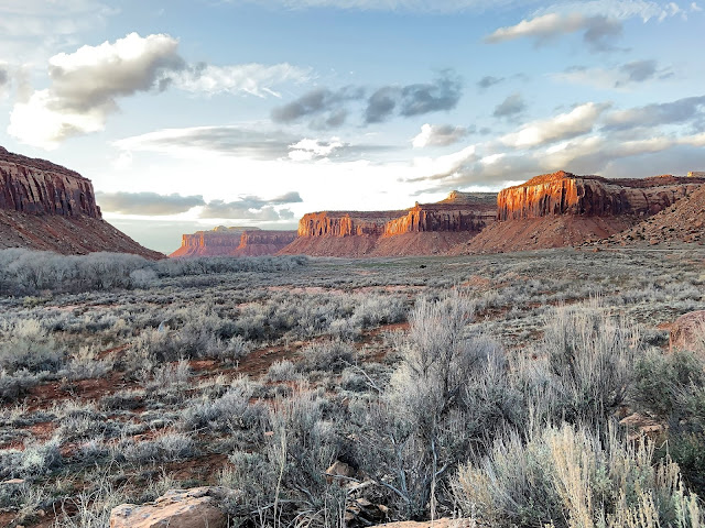
We flew in from DFW to SF on Friday, June 14th in the evening...Lu arrived before we did and had the rental car ready to go. He picked us up from the airport and we headed North from SF to Shasta. We stopped at Wal Mart for food and drove 4.5 hours North to the base (picture above) of Shasta. We arrived before 3 a.m. and slept in the car for a few hours before heading over to the 5th season (gear shop) to obtain permits and last second items. Permits cost $20 pp to climb past 10,000' on Shasta. ***Note: 5th Season Gear Shop is known as the best gear shop around...however, they gave Lu very poor rental gear and advice:
1) They told him his boots were not good enough for the mountain (Oboz Sawtooth GTX) which we din't question until we saw a climber near the top of the mountain with same boots...
2) The shoes they did rent him were 1/2 size to big because they didnt have any his size...and the waterproofing no longer worked...as Lu learned the next day when his feet were soaked.
3) They advised him that he didn't need gaitors this time of year...which resulted in snow entering his boots.
4) They told us the snow was consolidated and didn't need snow shoes...I felt like snow shoes would have helped us up to Lake Helen Base Camp since the snow was really soft.

After getting our gear and eating breakfast at a local bakery...we headed up to Bunny Flat TH. The town of Mt. Shasta sits at 3600'...so we drove up a few thousand feet on Everitt Memorial Hwy. The drive up is pretty scenic, through tall pines...and good views of Shasta above.

(Lu and Sarah at TH)
We officially started our ascent at 10:30 a.m. The base of the mountain (below tree line) was snowfree, dusty, and mainly shaded from the pines. Our first goal was to hike up nearly 1000' to horse camp.


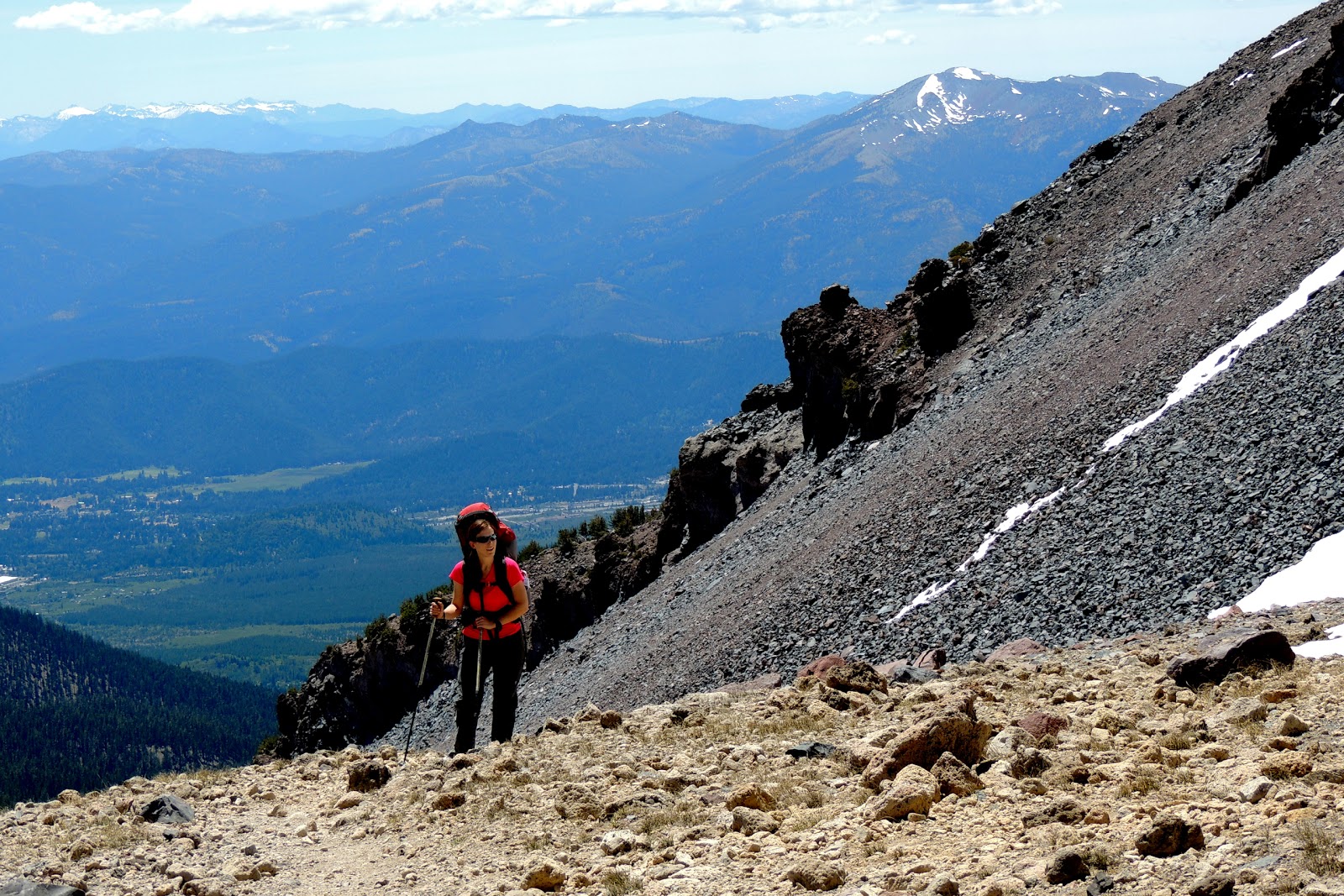
(Views of the ranges to the West of us)


Below treeline and up to Horse Camp...there are signs at the junctions that help you navigate through the pine forest.

After hiking 1.7 miles and climbing 1000', or an hour's hike from TH...you arrive at Horse Camp/Sierra Club Cabin.

There are 4 kinds of people here:
1) The camp host...who stays in a nearby tent for most of the Summer...She's in dark clothing in the doorway.
2) Day Hikers who make this place their destination for the day...who are excited to see the mountain above from treeline.
3) Climbers who stop here on their way up...to take a break and fill up their water at a nearby spring...these people are generally easy to spot. Loaded packs, big grins, and uber excited.
4) Climbers on their way down...Easy to spot...dusty, dirty, sweaty, exhausted, and relieved. Typically not smiling...just relieved.


Sarah and I before I turned into a diva...

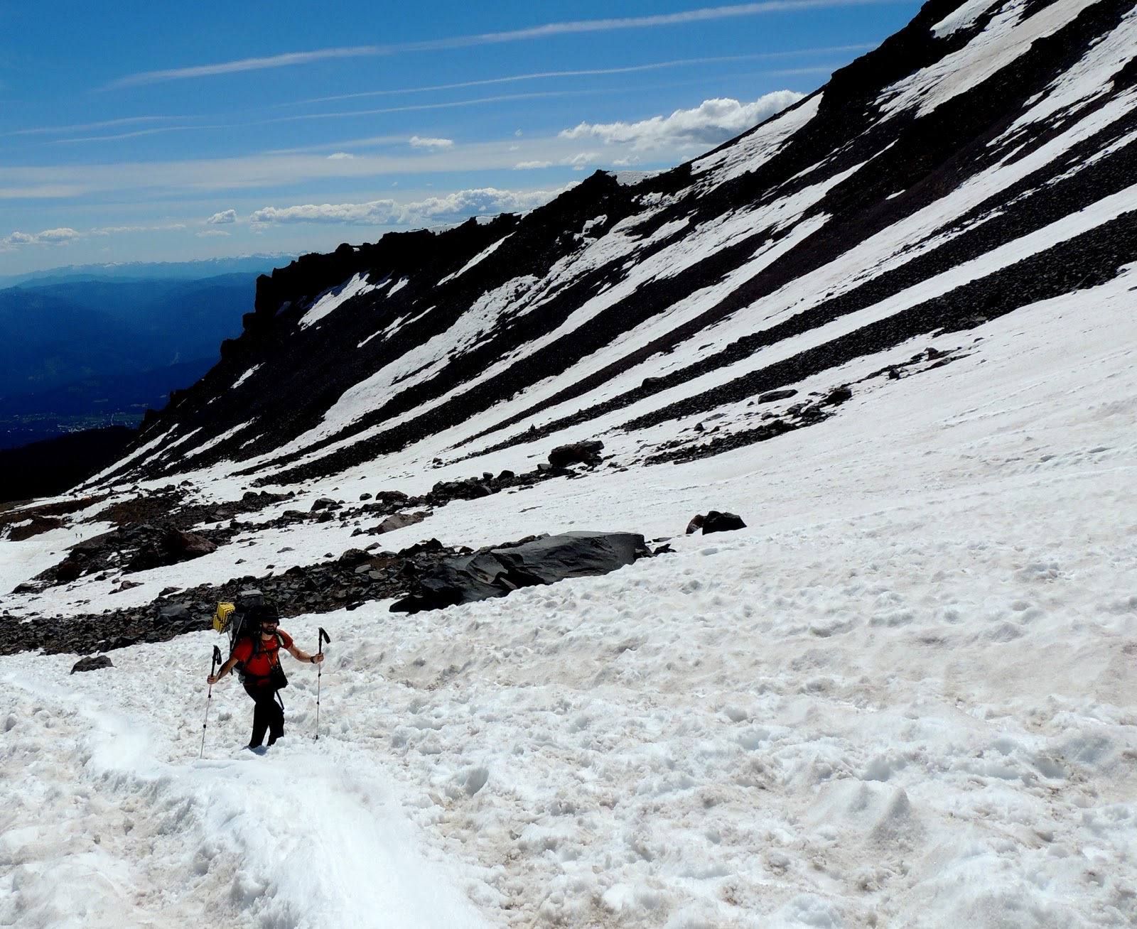
I zoomed in to take a picture of Lu making his way to camp...If you see closely, you can make out the tents on the rock ridge above Lu. The Ranger tent is the larger tan colored tent on the right.

The slope angle is not too bad here...however...imagine doing it for 1000', 1/2 mile, in soft snow...it can be a thigh burner.


After setting up camp...we melted snow into water so we would have enough to drink that night and have our camelbaks filled for the next day...I am now officially going to retire my snowpeak stove and will be making an investment in Jetboil...This stove took way too long to melt snow.


1) After climbing near 3000' on snow and ice...you crest over and realize you have to go up 500' more...with no summit in view.
2) You are exposed to the winds after leaving the chute
3) Man, you are just tired...you feel miserable...and you still have to go up.


and at 14,179'...we are finally at the top!
This is by far the most difficult challenge I have completed...not the most technical, but by far the most enduring, tiresome mountain I've climbed. We started at 5 a.m. and reached the top by 10 a.m. Looking back...I am really proud that we ended up climbing this in 5 hours from base camp. I thought it was going to take us longer. We spend 20 minutes up top...

We hung out for an hour or so...drank plenty of water...ate a few snacks...packed up our gear...and headed down the rest of the mountain. We glissaded down to 50/50 flat...hiked down to Horse Camp...and finally back down to Bunny Flat TH. It took almost 4 hours to get back down to the car...We were glad to be back down safe and sound.
BTW...there were never any strong winds and the storm never came. We loaded up the car, drove down to the town...and had a few beers to celebrate. Shasta was a success!
****UP NEXT, YOSEMITE NATIONAL PARK****
I envy what you were able to do. I'm also a flatlander but I've only done a handful of 14ers in CO. w/o snow. I also love your spiritual comments. Bruce in Iowa
ReplyDeleteBeing born in the town of Mt. Shasta to the daughter of the Forest Ranger, I remember hearing stories of climbers and rescuers as a child, but I never really understood the magnitude of what it takes to climb this mountain. I thoroughly enjoyed this post and am forwarding it to Dad. Blessings to you.
ReplyDeleteFantastic Blog! with useful info and great pictures.........Keep Writing
ReplyDeleteMount Shasta Tours
Thank you for sharing your adventure! Mt. Shasta's Avalanche Gulch route sounds both challenging and rewarding. Inspiring trip report.
ReplyDeleteMt Shasta Tour Guide
Thank You and that i have a swell provide: What House Renovations Can You Claim On Tax house renovation shows on netflix
ReplyDelete