Eagle Rock Loop

Advice from a Tree By Ilan Shamir
Sink your roots deeply into the Earth
Reflect the light of a greater source
Think long term
Go out on a limb
Remember your place among all living beings
Embrace with joy the changing seasons
For each yields its own abundance
The Energy and Birth of Spring
The Growth and Contentment of Summer
The Wisdom to let go of leaves in the Fall
The Rest and Quiet Renewal of Winter
And delight in their presence
Look up at the moon that shines down upon you
And the mystery of the stars at night.
Seek nourishment from the good things in life
Simple pleasures
Earth, fresh air, light
Drink plenty of water
Let your limbs sway and dance in the breezes
Be flexible
Remember your roots

Eagle Rock Loop (Arkansas)
Ouachita National Forest
Ouachita National Forest
Who: Brad Hardin (Brother in Law), Anthony Haynes, Travis Strausser and Me
When: March 5-6, 2011
Mileage: 26.8 miles
Mileage: 26.8 miles
Elevation Gain: 3114'
Elevation Loss: 3074'
Total: 6,188'
6 Mountain ridges
numerous creek crossings (most are easy, some are manageable, and there were 4 times we needed to change out into our water shoes to cross, one being mid thigh up.)
Total hiking time (including breaks and lunch): 16:17 hours
Total hiking time (including breaks and lunch): 16:17 hours

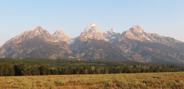
The Eagle Rock Loop just may be the best hike in the Ouachita Mountains, combining rugged hill climbs though the mixed hardwood and pine forest with strolls along crystal clear streams. The loop is made of three trails and, with 5 trailheads, offers a multitude of hiking options. The hardwoods in this section of the Ouachita National Forest are oak with some maple. The pines are short leaf and loblolly. In the winter the smaller but evergreen holly trees are a striking contrast to the gray brown of the forest floor.

March 5 (Saturday), 2011
Start: 8:00 a.m.
Finish: 5:15pm
TH start: FR 106 East Trail Head, 2 miles Southwest of Albert Pike Recreation Area.
Started out at 8 a.m., and got going…we all felt great and were really excited about the loop. Our original plan was to do this trip in 3 days, however, the previous day called for 40-80% chance of rain and thunderstorms so we decided not to chance it. It would call for a cold miserable night that no one would enjoy. Turns out, the area didn’t get much rain…figures. The temps on this day were in the high 40s for the most part. The wind blew at a stead 10-15mph with a few gusts reaching 25-30 mph. The water was clear and must have been hovering above freezing. But it felt great!

Most of the water crossings were shallow and could be crossed without taking off boots. If you have goretex boots, you are in great shape to cross these creeks and streams, most crossings the water only came up an inch or two on your boot. On deeper crossings, you could just hop on rocks if you have decent balance and poles. There are only two crossings on this day that we needed to change out shoes to get across. We met a younger solo hiker on one of these deep crossings who looked like he was sporting his grandfather’s gear, had three pair of regular long socks on and had no poles…he looked like he was carrying 50 pounds of weight…felt sorry for the guy. I offered my water socks to get across but he declined. He managed to make two poles out of fallen timber…didn’t matter, he fell about thigh in and got his boots, socks, and denim pants soaked. His next several miles were sure to be uncomfortable.

After Albert Pike area, the trail slowly ascends all the way around to the NW corner of the loop alongside the Little Missouri River. It was really enjoyable and we enjoyed the relatively easier hike through the forest.
Then we started hiking south on the Athens-Big Fork Trail. This trail is where the ridge climbs begin. We hiked up two on this day…by this time, we had already hiked 12.4 miles, so we were tired. Our plan was to at least do half, if not more of the trail the first day…knowing that the next day was going to be more difficult. We hiked another 1.9 miles over two ridges, up 410 ft to Hurricane Knob ridge and down 443 ft to Straight CK back up 333 ft to Mt. McKinley ridge and descend down 412 ft to Long CK where we finished up the day at 5:15 p.m. Were were spent. We set up camp, made a fire, and enjoyed shooting stars. Temperature dropped to 31 degrees by 6am but my bag was a nice and toasty 71.8 degrees. I slept well.
March 6 (Sunday), 2011
Start: 8:00 a.m.
Finish: 4:02 p.m.
We all ate breakfast, loaded up our frozen gear, dethawed our hands and toes, and got going at 8 a.m. on the dot. We started making our way up Bier Ck Mountain right away. In the next 3 ½ hours we would complete the remaining 4 mountain ridges. But the toughest stretch was descending Leader Mt to Blaylock CK (569 ft) and then go up to Bush Heap Mt ridge (709ft). It felt like we went straight down, hiked a few minutes and then trekked right up the ridge…it wore us out.
We arrived to Viles Branch Horse Trail in 3.5 hours. We ate lunch at this point and just hung out by the creek for 45 minutes. We knew at this point, there would be no more elevation gain…just hike along the creek to finish up the day. We hiked another 3.5 miles on this trail and hiked numerous creek crossings until we hit Little Missouri River.
We got to our first crossing of the day which required a change of shoes. But it was welcomed…my dogs were barking and the icy cold water served as relief.

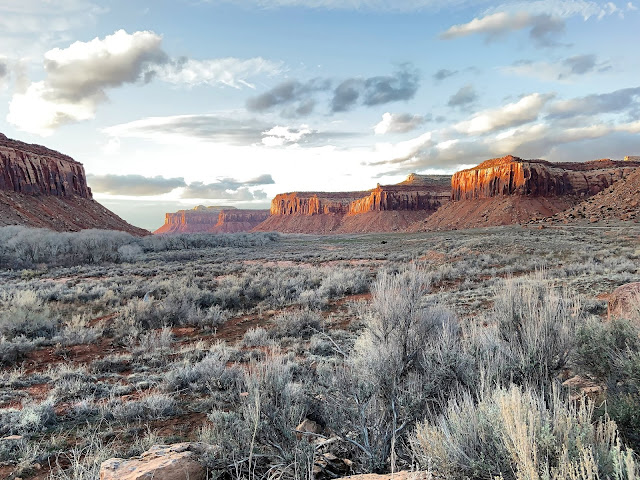
We crossed it and started making our way around the Winding Stairs area…this place is absolutey awesome. Clear water holes, little waterfalls, and good size cliffs are the views…I want to come back to this area alone and just hang out on a hot day!


We had to cross the Little Missouri one more time, which required that I get in thigh high…it was extremely cold, but I enjoyed it thoroughly. Travis, just stayed put in the middle of the river icing his knees.

Well, to our surprise…there was one more ascent that we did not expect…we read the topo map all wrong! Or maybe we were so tired and delusional that we didn’t even care to read it right…we just knew we were 1.5 mile away from the car. This last stretch going up felt like it took forever…but we made it through and completed the hike on this day in 7:02 hours.
I enjoyed the guys on this trip…they are all strong, great spirited, good attitude men who kept going. These guys make challenges like this enjoyable…I hope to hike/climb with these guys again.
Kudos to Anthony, who got a blister within the first mile on the first day and did not just complete this strenuous loop, he did not complain once. Rock on.
Comments
Post a Comment