Yosemite National Park: Half Dome Via Cables Backpacking Trip Report

"For behold, He Who forms the mountains and creates the wind and declares to man what is his thought, Who makes the morning darkness and treads on the heights of the earth—the Lord, the God of hosts, is His name!" Amos 4:13
There have been a few times in my life that I have felt in awe of a landscape...in awe to the point my jaw drops, brows raise, and am in utter reverence of such a powerful and magnificent work of creation. Lo and behold...Yosemite Valley! As you stand in the valley, and are surrounded by the massive granite walls, you can feel the presence of sheer power at work in this great valley. Everything has formed and continues to form from the powerful forces involved...From the roar of the towering waterfalls, the rushing cascades of valleys above, to the slow moving, gorge carving Merced River on the Vally floor...Yosemite is in constant motion.
Then there's the forces you don't see...I'm no geologist (though I wish I was), but this incredible landscape was formed deep within the Earth through volcanic activity, then the molten rock transforms to the granite we see today, which then is exposed by by the wind and water; then there's uplift and tilt, and then a period of glaciation that further carved the canyon. Furthermore, somewhere through all of this, this entire region was under ocean water which led to further layers of sediment and etc, etc...(Makes your brain hurt, huh?)
As you begin to understand the geological history and current forces at work...you can't help to marvel at this geological masterpiece. But then something interesting happens...and I believe it happens to most who enter this valley. We begin to size ourselves up in relation to this place...We begin to look above and wonder how far away things are...how far the waterfalls plummet, how long the river flows, how tall the trees stand?


...we are not even a speck. Down below in the valley, there's an entire village...millions of visitors a year, thousands of vehicles driving through, shuttle buses on their routes, visitor centers, park stores, lodges, and numerous campgrounds. Yet...it seems untouched and unvisited from above. So here I am...small and undetectable...within a large, majestic, fluid, and geological/historical framework of creation.
And as I continue to wonder about this creation...and my time in it...my heart and soul begins to yearn for it's Creator. Amos 4:13 gives us a description of a powerful and majestic God. A God that forms the beauty of the Earth...A God that carefully and mindfully molds the mountains and the canyons. The God who uses wind and water as His tools to purposely design the unique characteristics of a landscape. The God who oversees His design by day and night...and knows each chisel and stroke of His hand.
And also described in Amos 4:13, the God who designs the wonders and marvels of this world...is the same God who desires a relationship with the small and insignificant in relation to His larger works. God declares His thoughts to us...God wants us to know what He thinks. God wants us to know! God wants us to know Him! God wants us to know Him by Name!
God wants me to know Him...because God wants me! And though I don't register in this grand landscape of His, God makes it a point to make His name known to me. He finds and meets me in the meadows, under the shade of a tree, and on the top of the peaks. His desire is to be in a relationship with me. His desire is to be in a relationship with ME! and with YOU! and with the entire village...the millions who visit his creation...the drivers of those cars and shuttles...WITH EVERYONE!!!!
To think of this...well, again...my jaw drops in amazement, my brows raise in excitement, and am in utter thankfulness for a God that loves me! I LOVE YOU TOO!!!!!!

What: Summit Half Dome vis Cables Route
Who: Aaron "Lu" Lawler, Sarah Pasquel, and Ugly
When: 6/17 -6/19/13
Where: Yosemite National Park
Distance and elevation gain: 16 miles RT and 4,737' via the John Muir Trail (going up) and the Mist Trail (going down)

So after leaving the town of Shasta on the evening on June 16, we all jumped back into the car and drove 6.5 hours South towards Yosemite NP. We finally arrived to our cabin around 2 a.m., unloaded our gear and crashed from a long weekend on Mount Shasta. Though I was extremely exhausted from the exertion on Shasta and the long drive to the cabin...I barely slept. I would love to tell you that the anticipation of seeing YNP for the first time kept me up all night...but it wasn't. It was sleeping between Lu and Sarah that kept me up all night. For those of you close to us...just ask me to play you a video of that night. I recorded these two asleep...and it sounded like I went to bed with asthmatic, sick hippos. Nonetheless, mid morning rolled around and I finally woke them up. We gave ourselves a rest day (Monday June 17) to just enjoy the park like tourists.

We drove into the park from El Portal, paid the $20 weekly fee entrance and were gitty to see the valley. As soon as you drive in, you can see and hear the Merced River raging past you...the granite appears and the walls begin to increase in size. You drive by house size boulders and you begin to feel the excitement.

About 5 minutes into the park...you get your first glimpse of El Capitan. Of course we were floored...if you look closely enough on the wall,

you will find climbers all over it. My dream was to climb these walls one day...but I quickly realized that I have no way of training for this wall living in Texas. There is no way I will ever work up the endurance to climb these multi pitch routes. No way.

Let's move on...So we parked in Yosemite Village and decided to enjoy the day on easy trails and visit a few of the well known attractions. First thing we did was hike the 1 mile roundtrip Yosemite Falls trail. Yosemite Falls (pictured above) is the highest waterfall in North America. It drops three times for a total height of 2,425'. The longest single drop of this waterfall is 1,430'.

(Lu posing in front of waterfalls)
This is a very popular trail and quite busy...however, there are places you can escape to and find solitude if you look hard enough. We spent an hour here, enjoyed the views, ate lunch, and even rested...


We then decided to head up to Glacier point via Wowona Rd. On the way up Wowona Rd, you drive through a mile long tunnel and you have a chance to pull over and take in the best view of the valley.

After spending time there...we continued up Wowona Rd. and took a left onto Glacier point Rd. The drive from the valley floor to Glacier Point is almost an hour's drive. But it's completely worth it. A must do if you visit YNP. You get an incredible view of:

...HALF DOME...

...NEVADA FALLS...

...ROYAL ARCHES...

...YOSEMITE FALLS and YOSEMITE VALLEY.

We stayed up at Glacier Point for over 2 hours. We just sat and rested, took in the views, met a few people, and waited for the sunset. We were greatly rewarded for our patience...Sunset at Glacier Point is magnificent!

Alright...so let's talk about the Half Dome hike! For starters...you need a permit to hike up to half dome. You can either obtain one months in advance or hope you can show up the day before and hope to secure a lottery permit. The elevation gain is almost 5000'. Some people complete this route in a day...takes an average of 12 hours for most people to complete it...We wanted to fully enjoy the trail...so we broke it up into two days and decided to camp halfway up in Little Yosemite Valley (LYV). This way we can enjoy the sights, take time at each waterfall...camp in the backcountry...and get away from the hoards of people that would be summiting Half Dome later in the day (more on that later).

We started our hike from the hikers parking lot (dirt lot) near the upper pines campgrounds. The elevation starts near 4000' and you first get on Fen Trail on the way to the Happy Isle shuttle. It started out flat as we mad our way across...as you go through the Happy Isles Nature area, you cross over the Happy Isles Bridge, which you see above.

As you continue on the John Muir Trail (JMT)...you can see your first glimpse of Vernal Falls.

On the JMT...you are starting to gain elevation...the trail grade steepens. The Merced River will be running below and to your right. When you arrive to the bridge you see in the previous picture...you have two options to continue your way up towards Nevada Falls. You can either continue to take the JMT or the Mist Trail. The JMT is a little longer, not quite as steep, has several more switch backs to relieve you from the elevation gain and travels on South side of the Merced River. The Mist Trail is a little shorter, steeper, more direct, a bit more scenic, and is on the Northern side of the Merced. We chose to go up the JMT and descend via the Mist Trail the next day.

After leaving the junction (bridge area) and hiking a mile and over 1000' on the JMT...we crest over and get our first up close views of Nevada Falls. As you can see above...the trail is a nice class 1 trail and very well marked.


Nevada Falls is a 594' tall powerful waterfall. Probably the most powerful waterfall we saw in Yosemite. From the lot/TH, it took us close to 5 miles and nearly 2000' of elevation gain to get to. It's an incredible sight...and I'll have more picture of it later.

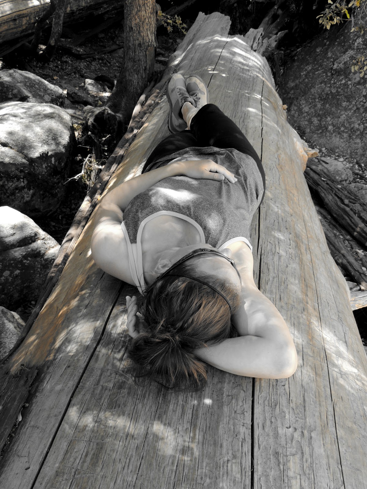
After spending close to an hour above Nevada Falls...we continued on to camp in LYV. From the top of Nevada Falls, you minimally gain elevation towards the backcountry sites. We arrived to camp some 6 hours later (like I said, we took our sweet time) and set up camp...we then walked over to the nearby Merced River and lazily hung out by the river the rest of the afternoon. We spent a few hours just hanging out...purifying water...eating dinner...watching hikers take a dip in the cold water...and watching Lu declare war on the friendliest colony of ants ever. I really believe these bugs kept him busy for a solid hour...it was like watching a little kid.
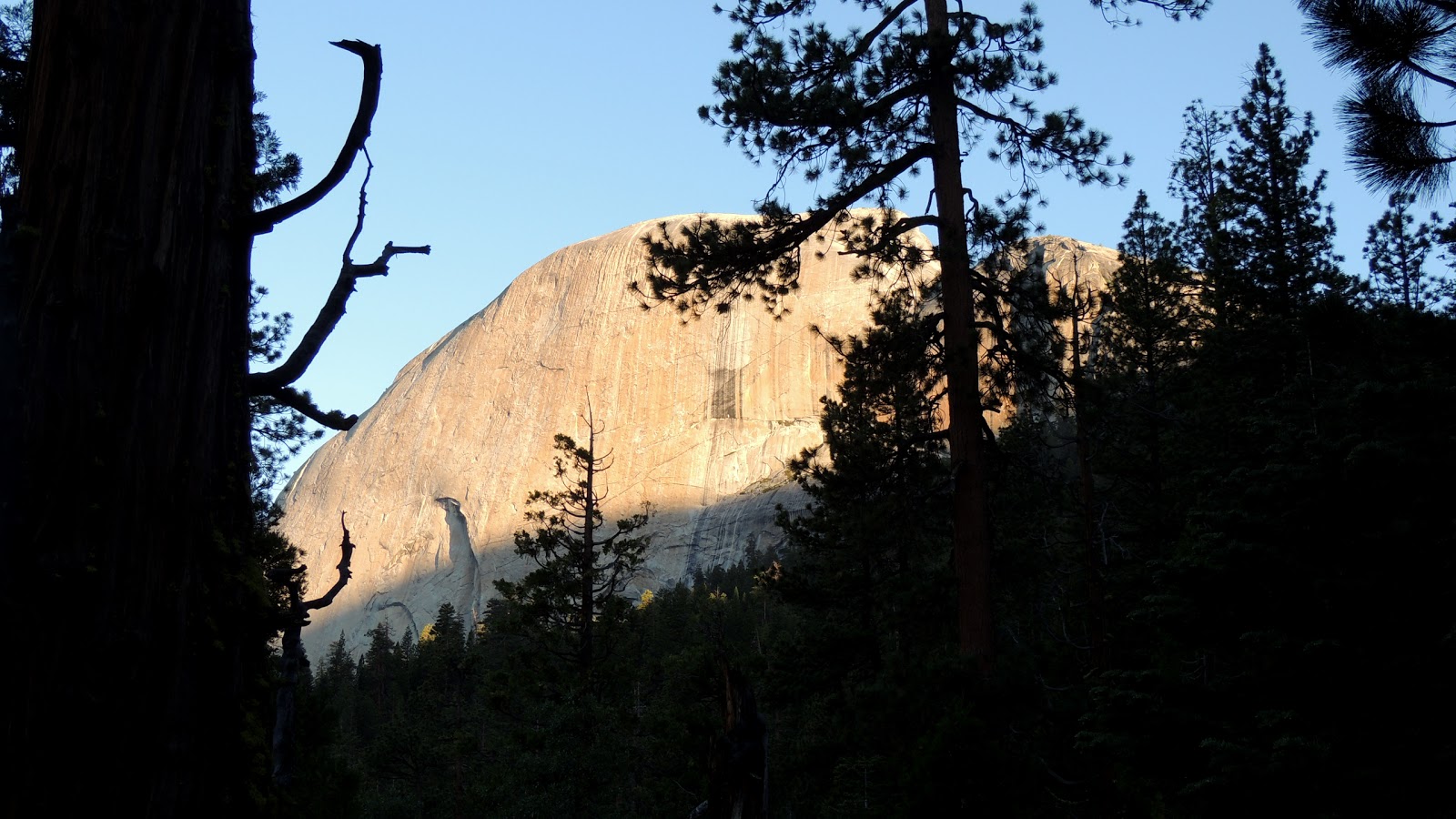
(Back of Half Dome)
Alright, so it's game time! After a good nights rest at camp, we started our way up to camp at 6 a.m. The thing about the Cables route is...it is very popular and can get very busy. Which means traffic jam on the cables. The cables route is almost 400' on a very steep slab of rock. So there is only one protected route up, hence the cables. I knew that the majority of Half Dome attempts are made by the day hikers that would be starting early...but they start from the very beginning. We were starting half way up. The goal for us was to get up, summit, and make our way down before the cables got too busy...


From camp to the top...it's another 3 miles and 2800' of elevation gain. So from LYV to the top of Half Dome there is more elvation gain than from the valley floor to LYV. The first couple miles are switchbacks through a pretty pine forest. As you crest over the ridge...you get your first views of the valley floor above. From here, you get an awesome view of Snow Creek Falls.

Here's another thing to note while attempting the hike up to Half Dome...there's another huge obstacle in the way named the Sub Dome. By this time...you're kind of tired. and yet...you have to go up a series of steep switchbacks that go up 400'. It's relentless, does not let up, and you are smoked after getting to the top. The plus side is...

...you get freakin awesome 360' views of YNP.

Here's Lu taking a break...looking back towards the LYV area. Down below there is where our backcountry site is...

Here's a look back at the trail ridge you hike up through...


Lu and Sarah making their way up the switchbacks...Mt. Watkins is in the background.

another view of hiking up Subdome.
When you crest over Subdome...you finally come face to face with the cables and Half Dome.

The cables go up 400'...and as you can see, our plan worked. There was no one there. It was 8 a.m. and everyone was still behind us...we had the cables to ourselves.

At the base of the cables are left over gloves...you need them. If you dont have your own...take a pair. The cables are made of steel and it's a long way up. You need the extra grip and it will save your hands from blistering up...

So here's a look at the cables from below...


(LYV)

Coming down is as fun as going up...


We finally descended all the way back to the TH after a long day. It took us 3 hours to get from camp to Half Dome Summit. Took us an 1.5 to descend back down to camp. Then it took us nearly 2 hours to go from LYV all the way back down to the car. It's a long, 16 mile roundtrip, close to 10,000' of elevation difference to complete this hike. But as you can see...it's a bucketlister. We loved every second of it!
***Up next...Humbled by the great Sequoias!***
About what time was the picture taken of the crowded half dome cables? My family wants to make it up this season, and wanted to plan when to start our 1 day trip to make it up to empty cables. Even worse, we have permits for a Saturday. Awesome read btw! Felt like I was the fourth hiker in your group!
ReplyDeleteThanks for the kind words...the picture of the cables were taken between 9:30-10:00 a.m. On a Saturday, you definitely want to get there sooner. The rock is slick and steep...last thing you want is to be exposed up there with a traffic jam. Good luck...love to hear about your experience up there.
DeleteThanks for the helpful advice. Will report back soon.
Delete0dacomunhe-Yonkers Mike Mejia https://www.oooshdrivingschool.co.uk/profile/Download-NEW-Free-Akruti-Oriya-Software/profile
ReplyDeleteemerenpref